In situ split calibration-validation
This script allows to separate the in situ polygons into a calibration set and a validation set. The user has to choose what percentage of pixels per class he wants to keep for calibration (pc_cal). The remaining pixels will be used to validate the classification.
Note that the script takes into account the fact that there cannot be calibration and validation pixels in the same polygon. If a pixel of a polygon is used for the calibration of the model, all the other pixels of this polygon are also used.
[29]:
import pandas as pd
import geopandas as gpd
import matplotlib.pyplot as plt
import matplotlib.patches as mpatches
import numpy as np
from collections import defaultdict
from pathlib import Path
Set directory
[30]:
computer_path = 'X:/'
grp_nb        = '99'

# Directory for all work files
work_path = f'{computer_path}STUDENTS/GROUP_{grp_nb}/'

in_situ_prepro_path  = f'{work_path}B_IN_SITU_PREPRO/'
in_situ_cal_val_path = f'{work_path}C_IN_SITU_CAL_VAL/'

Path(in_situ_cal_val_path).mkdir(parents=True, exist_ok=True)
Set parameters
[35]:
site = 'NAMUR'
year = '2020'

field_classif_code = 'grp_1_nb'
field_classif_name = 'grp_1'

pc_cal = 75
pc_val = 100-pc_cal
Set filenames
[36]:
# Input file
in_situ_prepared_shp = f'{in_situ_prepro_path}{site}_{year}_IN_SITU_ROI_prepared.shp'

# Output files
in_situ_cal_shp = f'{in_situ_cal_val_path}{site}_{year}_IN_SITU_ROI_CAL_{pc_cal}pc.shp'
in_situ_val_shp = f'{in_situ_cal_val_path}{site}_{year}_IN_SITU_ROI_VAL_{pc_val}pc.shp'

print(in_situ_cal_shp)
print(in_situ_val_shp)
/export/miro/ndeffense/LBRAT2104/STUDENTS/GROUP_99/TP/C_IN_SITU_CAL_VAL/NAMUR_2020_IN_SITU_ROI_CAL_75pc.shp
/export/miro/ndeffense/LBRAT2104/STUDENTS/GROUP_99/TP/C_IN_SITU_CAL_VAL/NAMUR_2020_IN_SITU_ROI_VAL_25pc.shp
1. Open in situ data prepared
[37]:
gdf = gpd.read_file(in_situ_prepared_shp)

display(gdf.head())
| id | lc_nb | lc | grp_nb | grp | class_nb | class | sub_nb | sub | grp_1_nb | grp_1 | grp_A_nb | grp_A | area | pix_count | geometry | |
|---|---|---|---|---|---|---|---|---|---|---|---|---|---|---|---|---|
| 0 | 4 | 3 | Grassland and meadows | 31 | Grassland and meadows | 319 | Grassland and meadows | 3199 | Grassland and meadows | 3 | Grassland and meadows | 3 | Grassland and meadows | 1735 | 17 | MULTIPOLYGON (((630003.573 5594258.004, 630003... |
| 1 | 5 | 3 | Grassland and meadows | 31 | Grassland and meadows | 319 | Grassland and meadows | 3199 | Grassland and meadows | 3 | Grassland and meadows | 3 | Grassland and meadows | 14331 | 146 | POLYGON ((636962.589 5595674.757, 636966.536 5... |
| 2 | 6 | 3 | Grassland and meadows | 31 | Grassland and meadows | 319 | Grassland and meadows | 3199 | Grassland and meadows | 3 | Grassland and meadows | 3 | Grassland and meadows | 1768 | 18 | POLYGON ((635692.119 5593303.601, 635688.405 5... |
| 3 | 7 | 3 | Grassland and meadows | 31 | Grassland and meadows | 319 | Grassland and meadows | 3199 | Grassland and meadows | 3 | Grassland and meadows | 3 | Grassland and meadows | 7828 | 79 | POLYGON ((627911.368 5595749.375, 627942.033 5... |
| 4 | 9 | 3 | Grassland and meadows | 31 | Grassland and meadows | 319 | Grassland and meadows | 3199 | Grassland and meadows | 3 | Grassland and meadows | 3 | Grassland and meadows | 3197 | 39 | POLYGON ((633236.525 5596165.100, 633397.286 5... |
2. Add number of pixel of each class for each polygons
crop_pixel : sum of all pixels belonging of all polygons of a given class
All polygons from a same class will have the same pixel ratio !
[39]:
gdf['crop_pix'] = gdf.groupby(field_classif_code)['pix_count'].transform('sum')

df = gdf[[field_classif_code,field_classif_name,'crop_pix']].drop_duplicates().sort_values('crop_pix', ascending=False)

df
[39]:
| grp_1_nb | grp_1 | crop_pix | |
|---|---|---|---|
| 221 | 1111 | Winter wheat | 29633 |
| 0 | 3 | Grassland and meadows | 23889 |
| 295 | 1121 | Maize | 8667 |
| 331 | 1811 | Sugar beet | 7400 |
| 352 | 1152 | Barley six-row | 6659 |
| 441 | 1511 | Potatoes | 6439 |
| 376 | 1192 | Other cereals | 6117 |
| 411 | 1771 | Peas | 3606 |
| 502 | 69 | Forest | 3109 |
| 401 | 1923 | Flax hemp and other similar crops | 2810 |
| 455 | 21 | Fruits trees | 2239 |
| 421 | 1435 | Rapeseed | 1826 |
| 466 | 81 | Urban | 1795 |
| 409 | 121 | Leafy or stem vegetables | 1351 |
| 393 | 1171 | Oats | 776 |
| 434 | 1911 | Alfalfa | 554 |
| 429 | 84 | Greenhouses | 252 |
| 462 | 9212 | Permanent rivers and streams | 208 |
| 372 | 22 | Vineyards | 178 |
3. Split polygons in training and validation datasets
[40]:
training_pixels = defaultdict(lambda: 0)
training_target = {}

cal_id_list = []
val_id_list = []

gdf_shuffle = gdf.sample(len(gdf), random_state=1)  # Shuffle geodataframe randomly

for i, row in gdf_shuffle.iterrows():

    id          = row['id']
    crop_code   = row[field_classif_code]
    crop_pix    = row['crop_pix']
    pix_count   = row['pix_count']

    crop_target = pc_cal/100 * crop_pix
    training_target[crop_code] = crop_target

    pixels = training_pixels[crop_code]

    if pixels + pix_count <= crop_target:  # If below crop target, add polygons in training set
        training_pixels[crop_code] = pixels + pix_count  # Update number of training pixels by crop code
        purpose = 0  # calibration
    else:                                  # If over crop target, add polygons in validation set
        purpose = 1  # validation because "crop target" is reached

    if purpose == 0:
        cal_id_list.append(id)
    else:
        val_id_list.append(id)


print(f'Number of polygons for training   : {len(cal_id_list)}')
print(f'Number of polygons for validation : {len(val_id_list)}')

cal_gdf = gdf[gdf['id'].isin(cal_id_list)]

val_gdf = gdf[gdf['id'].isin(val_id_list)]
Number of polygons for training   : 423
Number of polygons for validation : 114
Get summary of the CAL/VAL splitting
[27]:
# Get number of pixels per class

pix_per_class_cal_df = cal_gdf.groupby([field_classif_code, field_classif_name])['pix_count'].agg('sum').to_frame().reset_index()
pix_per_class_cal_df = pix_per_class_cal_df.sort_values(by='pix_count', ascending=False)
pix_per_class_cal_df = pix_per_class_cal_df.rename(columns={"pix_count": "CAL_pix"})

pix_per_class_val_df = val_gdf.groupby([field_classif_code, field_classif_name])['pix_count'].agg('sum').to_frame().reset_index()
pix_per_class_val_df = pix_per_class_val_df.sort_values(by='pix_count', ascending=False)
pix_per_class_val_df = pix_per_class_val_df.rename(columns={"pix_count": "VAL_pix"})

# Get number of polygons per class

poly_per_class_cal_df = cal_gdf.groupby([field_classif_code, field_classif_name])[field_classif_code].agg('count').reset_index(name='poly_count')
poly_per_class_cal_df = poly_per_class_cal_df.sort_values(by='poly_count', ascending=False)
poly_per_class_cal_df = poly_per_class_cal_df.rename(columns={"poly_count": "CAL_poly"})

poly_per_class_val_df = val_gdf.groupby([field_classif_code, field_classif_name])[field_classif_code].agg('count').reset_index(name='poly_count')
poly_per_class_val_df = poly_per_class_val_df.sort_values(by='poly_count', ascending=False)
poly_per_class_val_df = poly_per_class_val_df.rename(columns={"poly_count": "VAL_poly"})


# Merge 2 previous dataframe in a single one
#pix_poly_per_class_df = pix_per_class_cal_df.merge(poly_per_class_df, on=[field_classif_code, field_classif_name], how="outer")


# Merge 4 previous dataframe in a single one
summary_df = pix_per_class_cal_df.merge(pix_per_class_val_df,on=[field_classif_code, field_classif_name]).merge(poly_per_class_cal_df,on=[field_classif_code, field_classif_name]).merge(poly_per_class_val_df,on=[field_classif_code, field_classif_name])

display(summary_df)
| grp_1_nb | grp_1 | CAL_pix | VAL_pix | CAL_poly | VAL_poly | |
|---|---|---|---|---|---|---|
| 0 | 1111 | Winter wheat | 22187 | 7446 | 56 | 18 |
| 1 | 3 | Grassland and meadows | 17914 | 5975 | 176 | 45 |
| 2 | 1121 | Maize | 6477 | 2190 | 26 | 10 |
| 3 | 1811 | Sugar beet | 5416 | 1984 | 15 | 6 |
| 4 | 1152 | Barley six-row | 4958 | 1701 | 17 | 3 |
| 5 | 1511 | Potatoes | 4826 | 1613 | 12 | 2 |
| 6 | 1192 | Other cereals | 4434 | 1683 | 12 | 5 |
| 7 | 1771 | Peas | 2454 | 1152 | 8 | 2 |
| 8 | 69 | Forest | 2314 | 795 | 31 | 4 |
| 9 | 1923 | Flax hemp and other similar crops | 2074 | 736 | 7 | 1 |
| 10 | 21 | Fruits trees | 1551 | 688 | 6 | 1 |
| 11 | 81 | Urban | 1344 | 451 | 29 | 7 |
| 12 | 1435 | Rapeseed | 1176 | 650 | 4 | 2 |
| 13 | 121 | Leafy or stem vegetables | 571 | 780 | 3 | 1 |
| 14 | 1171 | Oats | 549 | 227 | 7 | 1 |
| 15 | 1911 | Alfalfa | 406 | 148 | 5 | 2 |
| 16 | 84 | Greenhouses | 183 | 69 | 3 | 2 |
| 17 | 9212 | Permanent rivers and streams | 152 | 56 | 3 | 1 |
| 18 | 22 | Vineyards | 131 | 47 | 3 | 1 |
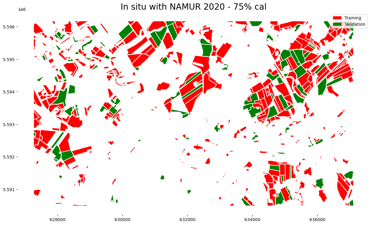
Plot calibration and validation in situ data
[42]:
fig, ax = plt.subplots(1, 1, figsize=(15,15))

cal_gdf.plot(ax=ax,
            color='red')

val_gdf.plot(ax=ax,
            color='green')

ax.set_title(f'In situ with {site} {year} - {pc_cal}% cal',fontsize=20)

cal_patch = mpatches.Patch(color='red', label='Training')
val_patch = mpatches.Patch(color='green', label='Validation')


plt.legend(handles=[cal_patch, val_patch])

plt.box(False)
Write geodataframe into a shapefile
[43]:
cal_gdf.to_file(in_situ_cal_shp)
val_gdf.to_file(in_situ_val_shp)

print(f'Two shapefiles have been created :\n {in_situ_cal_shp} \n {in_situ_val_shp}')
Two shapefiles have been created :
 /export/miro/ndeffense/LBRAT2104/STUDENTS/GROUP_99/TP/C_IN_SITU_CAL_VAL/NAMUR_2020_IN_SITU_ROI_CAL_75pc.shp
 /export/miro/ndeffense/LBRAT2104/STUDENTS/GROUP_99/TP/C_IN_SITU_CAL_VAL/NAMUR_2020_IN_SITU_ROI_VAL_25pc.shp